|
Copyright © Ray Crowther 2025 |
||||||||||||||||||||||||||||||||||||||||||||||||||||||||||||||||||||||||||||||||||||||||||||||||||||||||||||||
| The Home of Internet Table-Top Rallying
|
||||||||||||||||||||||||||||||||||||||||||||||||||||||||||||||||||||||||||||||||||||||||||||||||||||||||||||||
| Rallying Links | Contact | Search Website | ||||||||||||||||||||||||||||||||||||||||||||||||||||||||||||||||||||||||||||||||||||||||||||||||||||||||||||||

Top Table
Coming Events
Lost the Plot?
You're on the right website to get back on track. Savvy Navvy
No paper maps
|

 HRCR Internet Table-Top Rally Championship 2025
The usual 4 Championship rounds, each with 8 route cards (the best 7 to count) and 24 days to solve and plot.
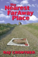
Predominantly plotting, the navigation will be varied and based upon usual techniques, though a couple will be more complex in terms of solution or plotting. Hints will be available in some cases, albeit with a time penalty. There might be a driving test and a couple of real-time legs, just to mix things up a bit. The Best 3 scores over the 4 rounds will be used for Championship positions. There will be 4 classes: Masters, Experts, Novices and Beginners. I've analysed all registrants' performances since 2012 to evenly spread them into three equal groups: Masters, Experts and Novices. This will be the class that will be initially assigned to entrants in the 2025 Championship. It will be updated to include only those that are on the final entry list. Anyone who registered for any event, but then didn't compete; those that haven't competed since 2012; and new registrants will be classified as a Beginner. The organisers will reclassify a competitor if they think it would provide fairer competition. Competitors may request to move up a class (but not down) if they think it would be appropriate. There is two-part "Entry Fee". The funds in the ITTR non-profits bank account to cover the map routing and hosting fees will need to be topped up on this event, so there will be a nominal (part 1) admin charge of £5. The HRCR have generously sponsored the awards for the event so there will be prizes for the best 10% of competitors. Part 2 requires entrants to self-certify a payment of £20 or more (money or goods for re-sale) to a charity of their choice. (The individual amount donated will not be public.) This will add to the ~£40,000 that ITTR has raised in total for charities. If you want to put in a dummy entry, simply as a means of charitable giving, please do so. The events will run as follows: July 1, 2025 - July 24, 2025 - The Nearest FarAway Place Rally August 1, 2025 - August 24, 2025 - Panglossian Rally September 1, 2025 - September 24, 2025 - Schoolfrenz Rally October 1, 2025 - October 24, 2025 - Thalamorph Rally Although the Championship starts in the summer months, the generous 24 days to complete 8 route cards should mean you can work around any holiday dates. May the Plot be with you. "Crow" 
March 9, 2025
Introduction |
Entry List |
Bulletins |
Championship Positions |
Photo Gallery
The Nearest FarAway Place Rally: Results Report Report 2 Awards Panglossian Rally: Results Report Report 2 Report 3 Schoolfrenz Rally: Results Report Thalamorph Rally: Results Report Entries: 49 - Money/Goods Benefitting Charities: £1444.5
CrowMayHem Rally 2025
After a gap of over a year, Internet Table-Top Rallying (ITTR) returns with this one-off event called the CrowMayHem Rally.
Organised by "Crow" and running in May (10th (22:00) - 31st (22:00)) it will definitely not be mayhem. Quite the contrary, it is an event designed to get loyal competitors back into the swing of digital plotting and will be an easy introduction for newcomers. Plus it will act as a warm-up event before the Internet Table-Top Rally Championship later in the year. The 10 Route Cards (all to count) will be straightforward rally navigation: map references, spot heights, tulips, grid lines, grid squares, herringbones etc without any trickery, encryption or necessary Googling, and your plotting will be on 1:50000 OS Maps. This is an open event, i.e. no classes. I expect a lot of clean sheets regarding correct route, so you may want to reserve a quiet session for speedy solving and plotting, as your elapsed time will be used in tie-deciding. If you are unfamiliar with or need practice on marking a route on a digital map there are plenty of practice routecards available. There is no "Entry Fee". There are just sufficient funds in the ITTR non-profits bank account to cover the map routing and hosting fees directly incurred by this competition and to fund token awards for the best 10% of competitors. I do however require entrants to self-certify a payment of £10 or more (money or goods for re-sale) to a charity of their choice. (The individual amount donated will not be public.) With around 70 entries the total value raised by ITTR for charity will exceed a magic amount of £40,000. Please enter and help me achieve this target, even if it's merely a dummy entry, simply as a means of charitable giving. May the Plot be with you. "Crow"
March 9, 2025
Introduction |
Entry Form |
Entry List |
Bulletins |
Results Summary
Entries: 56 - Money/Goods Benefitting Charities: £1052.25
OFCAWS
OFCAWS is a browser-based mapping application that uses maps from various
providers: Ordnance Survey, Google, Open Street and others.
The core of the application has been used for 8 years in the Table-Top Rallying website. As a private, standalone mapping tool it has been used for route planning, rallying and geocaching. This public version was released in August 2020 and the majority of subscription fees are donated to charity. In July 2020 Ordnance Survey rolled out its new digital map series (OS Data Hub), and OFCAWS was one of first applications to use this technology. OFCAWS has access to the full set of current UK OS 1:50000 and 1:25000 maps, as well as map layers that zoom into street and building detail. Map sets from other providers are also included such as Google Road, Google Satellite, Open Street and specialist maps for cyclists, railways and history. Features within OFCAWS include the ability to search for place names, postcodes and points of interest; find locations from map references, latitude/longitude and what3words; add markers to the maps; use Google street view; the import and display of files containing routes and geocaches; saving and printing map extracts; coordinate conversion and projection; a magnifying window to examine map details (Spy); and a measuring tool (Roamer). The application will be a valuable tool for anyone that uses UK or World maps on a regular basis. For geocachers, geocaches can be imported from GPX, GSAK and Pocket Query files. Cache-type markers are placed on the displayed map, which when clicked will display the cache details and logs. Screen and printed reports from the cache list are also available. Linkage with a geocaching.com account allows the extraction of personal notes and corrected coordinates for display, which can added to an updated GPX for download to your GPSr. A FREE 24-hour trial is available by clicking OFCAWS. Thereafter a subscription for a year is £25 (minimum) - £20 (minimum) to charity and £5 to cover hosting/routing fees. Your subscription will add to the £39,000 that has been donated to Cancer Research, Alzheimer's Society, Multiple Sclerosis Society, MacMillan Cancer Support, Motor Neurone Disease Association, Ramblers Association and NHS Charities Together since 2004. 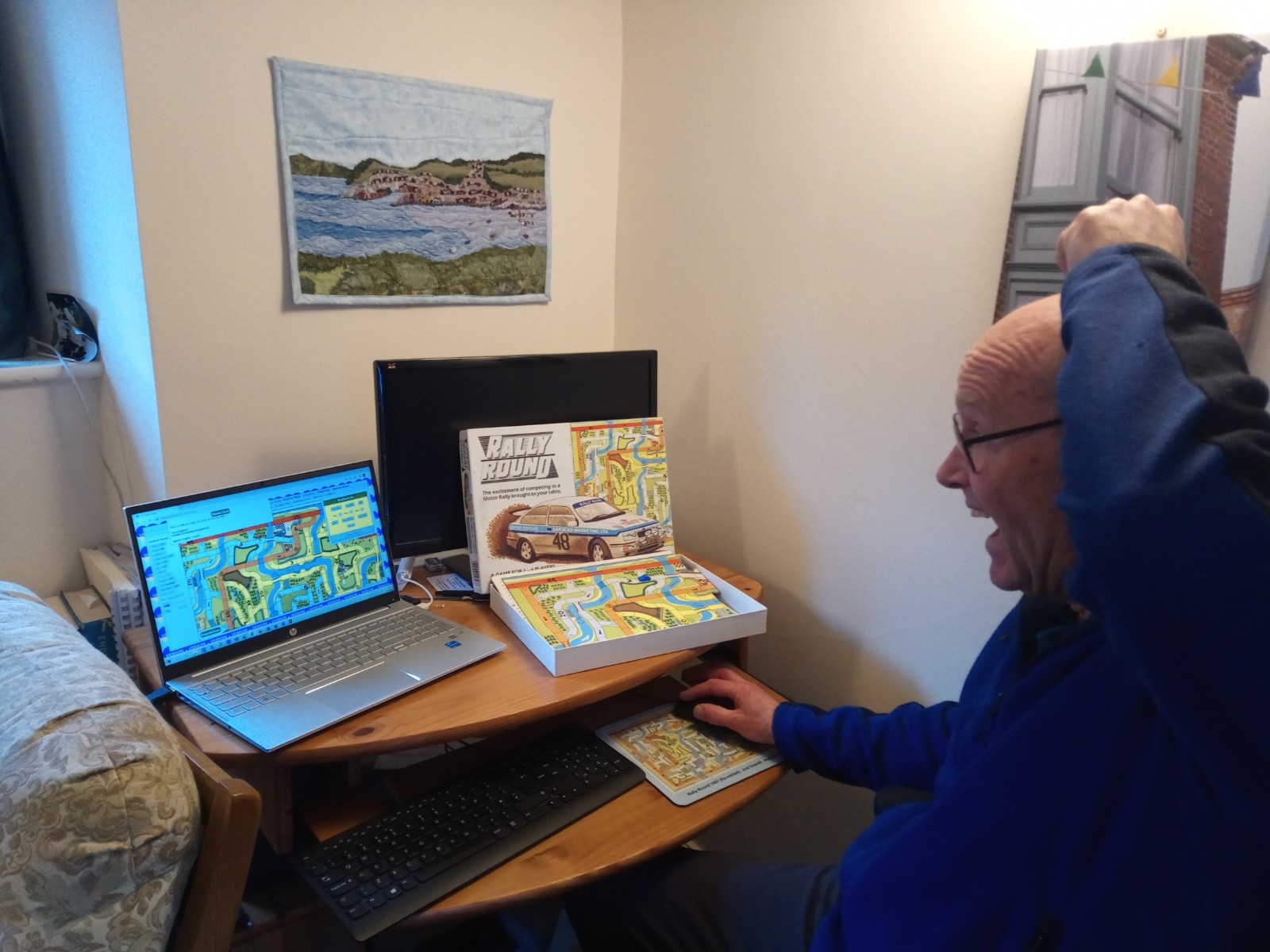
Rally Round 1987 Overload by runner-up Andrew Green  HRCR Internet Table-Top Rally Championship 2022
 CoRvid-19 Rally 2020/2021
corvid , /ˈkɔːvɪd/, noun, a bird of the crow family ( Corvidae ); a crow. |
|||||||||||||||||||||||||||||||||||||||||||||||||||||||||||||||||||||||||||||||||||||||||||||||||||||||||||||
|
|
||||||||||||||||||||||||||||||||||||||||||||||||||||||||||||||||||||||||||||||||||||||||||||||||||||||||||||||


 Competitor Admin
